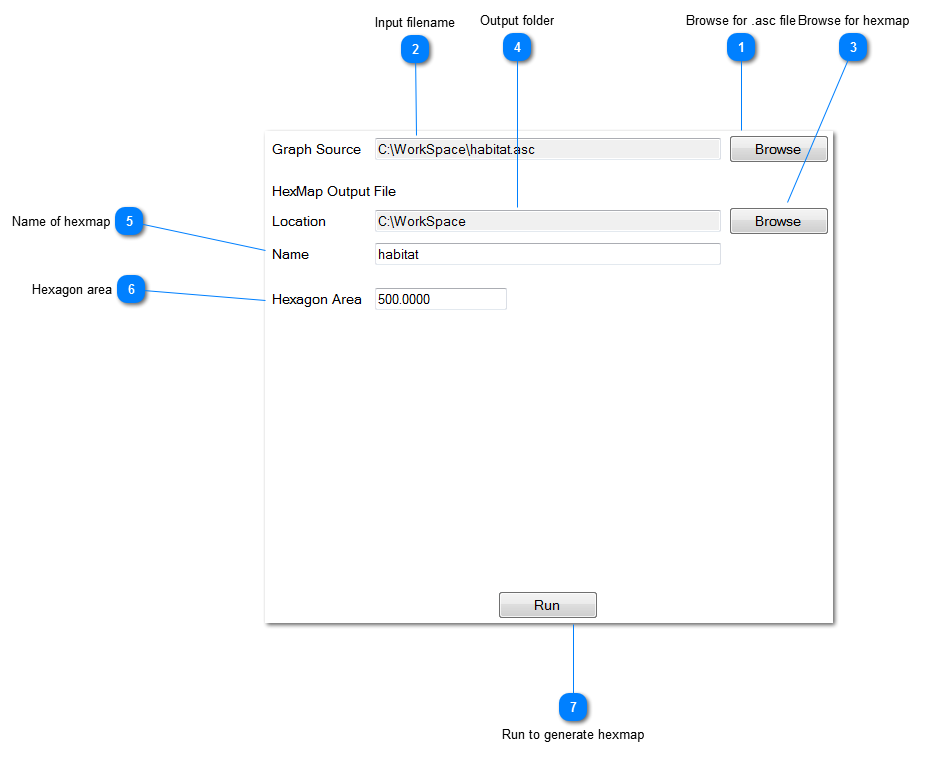
This tab allows generation of hexmaps and associated shapefiles and node coordinate files from input raster data (.asc files).
 Browse for .asc file
Locate the .asc file you have produced in a GIS program to represent habitat data.
|
|
 Input filename
Name of the .asc file 
|
|
 Browse for hexmap
Specify the location where the hexmap file will be placed
|
|
 Output folder
The .hxn suffix will be added to the filename you specify.
|
|
 Name of hexmap
Specify the name of the output hexmap. This prefix will also be used to name the output shapefile (which consists of associated .shp, .shx,. dbf files) and a textfile with node coordinates (.crd extension).
|
|
 Hexagon area
Specify the hexagon size in hectares. You can use the extent of your .asc and the maximum size of the graph you can process to derive an approximate desired hexagon size.
|
|
 Run to generate hexmap
|
|