Example 2: Shortest-path betweenness subset centrality
Case study: Analysis of landscape permeability in Washington with subset shortest-path betweenness centrality
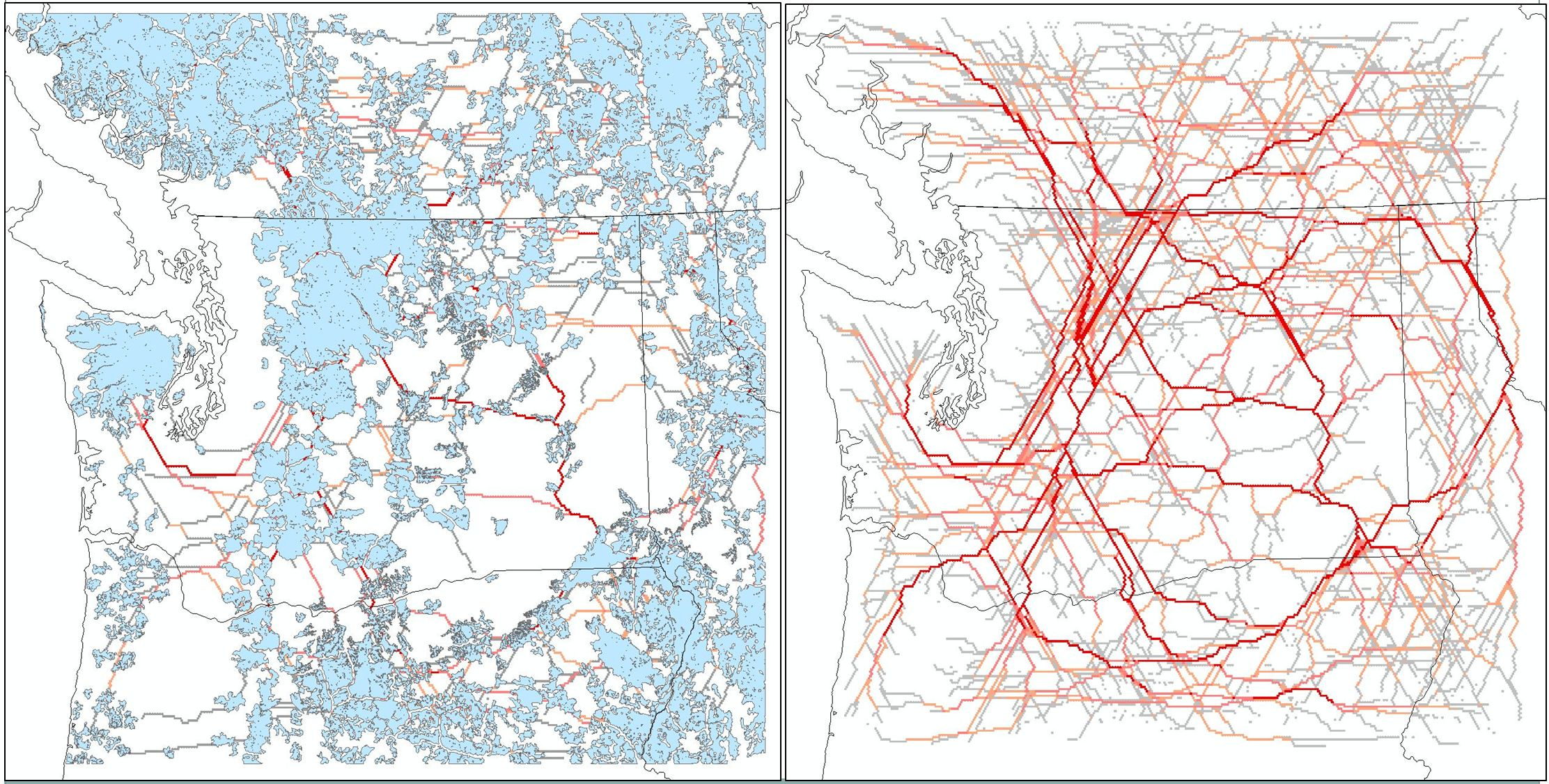
A similar landscape permeability layer was developed by the Washington State Wildlife Habitat Connectivity Working Group (
website). The project also developed a map of core areas in the state with high levels of 'landscape intactness'. To provide an example of the contrast between subset and all-pairs methods, these core areas (blue areas in left panel below) were used as source and target patches in an analysis using shortest-path betweenness subset centrality. Subset centrality results (left panel below) show only linkages between pre-defined core areas rather than between all sites on the landscape. Linkages of greater importance are shown in darker orange shades. These results may be easier for planners to interpret than all-pairs centrality results (right panel below), especially if the input core areas were based on a ecologically-relevant classification.